Sarah Li creates technology that helps satellites and aircraft make smart, real‑time decisions in crowded, unpredictable conditions.
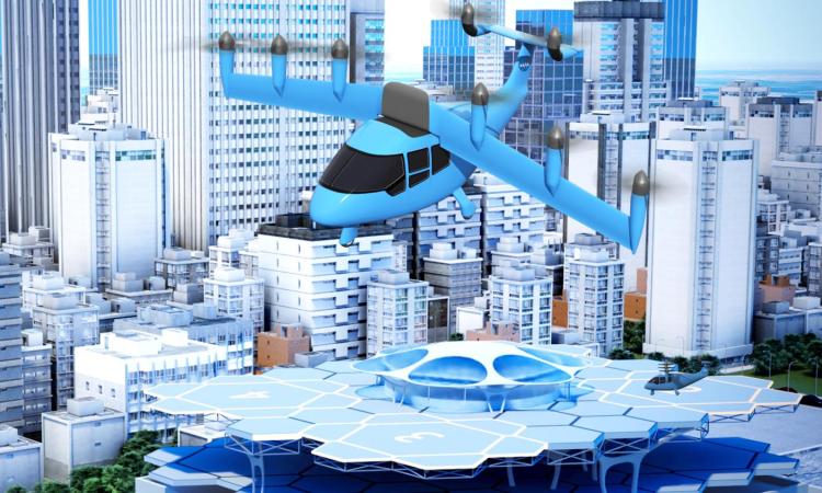
As the skies grow more congested, from low Earth orbit to downtown airspace, the need for smarter autonomous systems has never been greater. Collisions in space have become an expensive problem, and urban air mobility is an option worth exploring given the increasing traffic problems plaguing major cities.
Managing these complexities is a mathematical challenge and the Control, Coordination, and Competition under Uncertainty (C3U) Lab is tackling it head-on. Led by Assistant Professor Sarah H.Q. Li, the lab develops algorithms to help satellites make decisions to avoid orbital conflicts. She‘s developed an algorithm that allows a servicing satellite to assist other satellites that find themselves spinning out of control. Li is exploring airspace management for urban mobility, as well. She specializes in multi-agent systems and in interactive decision-making among autonomous vehicles, humans, and aircraft.


Preventing Debris from Derailing the Mission
Colliding with debris can end a satellite’s mission in an instant, causing significant damage or sending the spacecraft into an uncontrollable spin. With growing congestion in low Earth orbit, other objects in space can put satellites at risk, and a poorly timed maneuver, to avoid space debris or another spacecraft, can be just as dangerous as not maneuvering at all. Li’s research helps autonomous satellites reason through these encounters, coordinate with servicing satellites when needed, and decide when it’s safest to move or hold position.
“Satellite operators haven’t established methods to automate collision‑avoidance maneuvers,” Li said. “A major challenge is the significant uncertainty that space operators must manage. Uncertainty in space exceeds what ground‑based autonomous systems encounter.”
On Earth, autonomous vehicles generally know their precise location, so the problem becomes determining how far or in which direction to move. In space, position estimates can span hundreds of kilometers. Often, operators on the ground simply cannot determine whether two objects will collide. To move or not to move becomes a critical question, especially with large differences in fuel costs. Frequent moves can quickly deplete a satellite’s limited fuel. Li’s algorithm incorporates guidance used for ground‑based autonomous systems that’s modified to account for these challenges. Li’s paper presented at the American Institute of Aeronautics and Astronautics (AIAA) Astrodynamics Specialist 2025 Conference detailing this work.
Beyond collision avoidance, satellites must also survive an impact. When a satellite is hit by debris or accumulates momentum over time, it can begin spinning unpredictably. Once that happens, stabilizing the satellite becomes extremely complicated.
In a recent AIAA SciTech Forum paper, Li and her team demonstrated a momentum‑balanced contact strategy that enables a servicing satellite to safely approach and stabilize a free‑spinning object. They simulated a it equipped with a robotic arm that approaches the spinning object and matches its rotation. Once the two are synchronized, the robotic arm extends and grabs the spinning object and stabilizes its orientation.
They’re approaching this research in multiple stages. The core algorithm is already functional, so the team is building a higher‑fidelity simulation environment to validate their approach. Once they validate the algorithm through additional experiments, they will transition to physical tests using drones.
Navigating City Skyways
In addition, C3U is focused on urban mobility issues with shared air space. As traffic negatively impacts major cities, and supply and demand for goods increases, the airways become a major consideration for transportation in urban areas. Once more urban airways are open, much like highways, there must be a system to avoid collision and confusion.
In shared airspace, multiple drones, each traveling to their own destination, must navigate potential conflicts as they cross one another’s paths. To manage this, Li applies principles from auction theory. In this framework, drones “bid” for access to specific portions of the airspace based on vehicle-specific preferences like specific altitudes, routes and visibility.
“An auctioneer‑like mechanism, similar to an air traffic controller, evaluates these bids and assigns routes accordingly, sometimes granting a preferred path, and other times determining that no safe route is available. The system is designed to encourage each drone to bid truthfully according to its actual needs, preventing both overbidding and underbidding,” Li explained.
By ensuring truthful participation, the mechanism can allocate airspace efficiently and fairly, allowing individually optimal decisions to produce coordinated, system‑wide safety.
“Economic models typically assume a direct link between price and reward, but engineering doesn’t work that way,” Li said. “In our world, everything depends on dynamics—how vehicles move, how routes connect, and how safety constraints interact in real time. Our inputs are acceleration vectors to the drone, which controls how the drone moves through space, and the outputs are where it ends up. Only after that can we determine the true ‘reward.’ Engineering forces us to account for complex physical behavior. Part of my work is figuring out how to bridge those two worlds.”

Predictions from GoalPredictor and TrajAirNet vs true path of N624AQ
AI Anticipating Human Intent
C3U is also exploring how large language models (LLMs), advanced systems designed to understand and generate human language, can help autonomous aircraft understand human pilots. They are developing an LLM‑enabled system that can listen to real‑time radio communications and interpret pilot intentions, allowing autonomous aircraft to anticipate pilot in unpredictable environments rather than simply reacting to it.
In a recent paper Li co-authored, she examined how LLMs can predict and improve landings at airports without a control tower.
“We are looking at using LLMs to process information so autonomous systems can infer what pilots are planning,” Li explained. “By converting unstructured audio into structured content, the system allows autonomous aircraft to plan more safely.”
For Li, the project represents another step toward a future where autonomous vehicles can navigate complex, uncertain environments by understanding dynamics and the human language shaping the airspace around them.
(text and background only visible when logged in)
Related Stories:
Georgia Tech to Collaborate on $6.7 Million NASA University Leadership Initiative
Professor Kyriakos Vamvoudakis will collaborate with colleagues from academia and industry on a NASA University Leadership Initiative (ULI) grant to create intelligent systems for Advanced Air Mobility (AAM) that can independently learn and make safe decisions. These systems will be designed to consistently be aware of safety and ensure that the vehicles operate reliably and securely.
AE Professor’s Research Aims to Improve Decision-Making in Artificial Intelligence
Vamvoudakis received $400,000 from the National Science Foundation for his proposal, “Improving Safety by Synthesizing Interacting Model-based and Model-free Learning Approaches.” This is the first grant on Safe Learning-enabled Systems (SLES) awarded to Georgia Tech from NSF. He and his team will establish a framework that leads to the design and implementation of SLES in which safety is ensured with high confidence levels.